Amicalola Falls State Park to Hiawassee, GA


Photos:http://www.allenf.com/gallery2/main.php/v/AT2009/AFSPtoHiawassee/


Stover Creek Shelter

 
Wednesday 3/18
AT Miles = 2.8
Other Miles = 8.8
Total Miles = 11.6

Today was a perfect day to start a thru-hike. After days and days of rain, today was warm and sunny with a bit of haze. After a hearty breakfast at the Hikers Hostel in Dahlonega, six hikers piled into the truck to be shuttled to the trail. Only two of us had chosen to hike the Approach Trail from Amicalola Falls State Park. The trail starts at the stone arch behind the Visitors Center, then follows the paved trail up along the falls, which includes seven hundred and something stairs. Whew!

After I got out of the state park the trail turned quiet and lovely. It is quite different than New England, which I think of as mud, roots, and rocks. Here the trail was dry and smooth for easy walking. It was only the elevation gain that made the hiking hard.

I left Amicalola Falls at about 10:20 and arrived at the summit of Springer Mountrain at 1:50, much faster than I expected. I hadn't yet picked a final goal for the day. I could have stopped at the Springer Mountrain Shelter just 0.2 miles from the summit, but with about 6 hours of daylight left it seemed that pushing on a little further made sense, so I continued on the 2.8 miles to here, Stover Creek Shelter.

It's about 6:30 now. We've got blue skies and a gentle breeze, and the evening is starting to cool off. My hammock is hung out behind the shelter, and I think it is going to be wonderful sleeping weather tonight; fresh and chilly.

There is a fire going started by one of the3 other hikers. There are a half dozen hikers in the shelter, a few in tents 50 yards away, and me in my hammock.

The weather forecast I saw this morning before leaving the hostel called for a 30% chance of rain tomorrow, then sunny and warm for the rest of the week.

While hiking today I was thinking that so far this feels like just another weekend hiking trip. I wonder how long it will be before it starts transitioning from a hiking trip into a life-style.

Allen Freeman
allen@allenf.com
www.allenf.com


Stover Creek Shelter to Gooch Mountain Shelter

 
Thursday, 3/19

AT Miles = 12.3 / 15.1
Other Miles = 0.7 / 9.5
Total Miles = 13.0 / 24.6

While hiking today I kept thinking of things I wanted to talk about today, but now, at the end of a tiring day, I can't think of any of them.

It was another beautiful day. I actuakky wish it weren't so sunny, as there are no leaves on the trees yet and I am getting a bit burnt.

The day started off by hiking along old roadbeds that folowed Stover Creek, and it was tyhe perfect way to ease into the day. The first seven miles were easy, gentle walking. Then, after sucking me in to a complacent mood, the trail threw Sassafras and Justus Mountains at me. They were both steep and gave me a good workout. I definitely earned my dinner tonight!

When I got to Cooper Gap, between Sassafras and Justus Mountains, a previous thru-hiker with the trailname of The Prophet, along with his dog Noah, was parked at the road crossing with his pickup truck and giving out Dr Pepper and Budweiser. I didn't think a beer would be a good idea with a steep climb facing me, so I settled for a Dr Pepper (wouldn't you like to be a pepper too...).

The shelter and campsite tonight is jam packed; there are 11 hikers in the shelter and 7 or 8 tents pitched around the shelter.

Just as I was cooking my dinner tonight a brief shower rolled through, but the sun is out again now and it is a beautiful evening. I hear there is a 30% chance of rain tonight, so I'll be sure to get everything rigged for rain before going to bed.

I am now 15.1 miles from Neels Gap, whichis my next resupply. There is a hostel there as well. I thinjk I will stop a few miles short of Neels tomorrow night, then get in to Neels early on Saturday. I can then do my shopping, check out the hostel and decide if I want to stay over or keep heading up the trail. That way if I do stay over I'll hyave most of the day to relax.

Allen Freeman
allen@allenf.com
www.allenf.com


Gooch Mtn Shelter to Slaughter Creek

 
Friday, 3/20

AT Miles = 12.5 / 27.6
Other Miles = 0 / 9.5
Total Miles = 12.5 / 37.1

I like mornings. In the morning everything is quiet. The air is cool, the birds are singing, and the early morning light shows the world at its best. Also, in the morning my feet don't hurt.

I thoroughly enjoyed cruising along the trail this morning. I even saw one tree showing the first buds of spring. I think it is going to be great watching spring arrive day by day.

The spring equinox arrived at 11:44 this morning, and I greeted it seated at an overlook on Big Cedar Mountain in the Blood Mountain Wilderness area. What could be better?

By noon time my feet were starting to ache, and then the day turned a bit into just "getting there". But now I am cozily set up on the west side of the ridge near Slaughter Creek. How's that for a name to lull you to sleep at night?

It is getting quite chilly this evening so I think I will crawl into my hammock and read or listen to my little radio. It should be a great night for sleeping.

Tomorrow I have only 3.2 miles into Neels Gap. I think I will get there early, get a bunk in the hostel, and relax for the bulk of the day. I will buy supplies for the next four days there, which will get me to Hiawassee, GA.

Allen Freeman
allen@allenf.com
www.allenf.com


Slaughter Creek to Neels Gap

 
Saturday, 3/21

AT Miles = 3.2 / 30.7
Other Miles = 0 /9.5
Total Miles = 3.2 /40.2

Well, I masnaged to spend the night at a place named Slaughter Creek on the slope of Blood Mountain, and seem to have escaped with all limbs intact.

It was a cold night last night. Slaughter Creek is in a gap and the wind was roaring through. I finished dinner and had all my gear stored away by 7:00, and even though there was an hour of daylight left, I crawled into my hammock to get warm. I spent some time reading and listening to my little radio, then once the sun set I was off to sleep.

The wind never let up and the temperature must have fallen to just below freezing. There were ice crystals in some of the frozne mud along the trail first thing this morning, but it wasn't cold enough for any of the water in my bottles to freeze.

I got up a couple of times during the night and could see the lights inb the town of Dahlonega down in the valley below.

Todasy's hike was a quick 3.2 miles over Blood Mountain and down iknto Neels Gap. There is an outfitter and a hiker hostel in the gap right where the trail passes. In fact, the trail actually passes through a breezeway between the 2 buildings.

I've bought enough food for the next four days, which should get me to Dicks Creek Gap from where I will hitch into Hiawassee to picvk up my other sleeping bag that Jodi is mailing to me, and I will stock up for the next leg.

There was a group here cooking burgers for all the hikers, and after three of those my stomach feels quite happy.

I was hoping for internet access here so I could upload the photos I've taken so far, but it doesn't look like they have it so that will probably have to wait until Hiawassee, four days from now.

Allen Freeman
allen@allenf.com
www.allenf.com


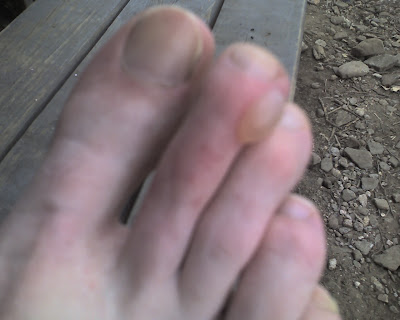
For Cassie


This one is for Cassie, since she wished a blister upon me! Love you too Cassie.

Allen Freeman
allen@allenf.com
www.allenf.com


Neels Gap to Blue Mountain Shelter

 
Sunday, 3/22

AT Miles = 18 / 48.7
Other Miles = 2.5 / 12
Total = 20.5 / 60.7

Staying at the hostel at Neels Gap was a nice break from hiking. I don't sleep very well in a bunk room with a bunch of other people, some of whom inevitably snore, but the comraderie with the other hikers staying there made up for the lack of sleep.

Here's something for you, Denis. On Saturday evening we were watching "Deliveranbce" in the hostel common room while Pirate, the hostel caretaker, was wearing a shirt that said "HIKE FASTER, I hear banjo music."

I left Neels Gap at 7:30 Sunday morning and settled into a nice rythm climbing out of Neels Gap, enjoying the early morning sounds. When I was a half hour out of the Gap, maybe a mile and a quarter, I finally realized that the hat that was supposed to be atop my head was instead still hanging on a hook in the bunkroom back at the hostel. There was nothing to do except turn around and head back down. That little misadventure added about an extra 2 1/2 miles to my day. My Dad used to tell me that just because my head came to a point didn't necessarily mean I was sharp. I guess he was right.

My destination for the day was Low Gap Shelter, but I arrived there at 1:45, which was too early to stop, so I decided to keep walking until 4:00pm and see where I was.

As it turned out where I was at 4:00pm was on a beautiful piece of trail, but there was no water so I had to keep going until I reached Blue Mountain Shelter at around 5:00pm. Blue Mountain is 18 miles from Neels Gap. Adding in the extra 2.5 miles I walked to retrieve my hat, I hiked a total of 20.5 miles, my first ever 20 miler!

Allen Freeman
allen@allenf.com
www.allenf.com


Blue Mtn Shelter to Tray Mtn Shelter

 
Monday, 3/23

AT Miles = 7.8 / 56.5
Other Miles = .3 / 12.3
Total Miles = 8.1 / 68.8

After yesterday's tough workout I slept a bit late this morning and was almost the last one to leave camp this morning. The day started with a couple of hard climbs, and I was not predicting where I might end up at the end of the day.

The climb out of Unicoi Gap was a tough one, then I crossed Rocky Mountain and descended down into Indian Grave Gap, then up and over until I climbed down into Tray Gap. In Tray Gap there was a man named Bill who had set up a gas grill and was cooking cheesebrgers for all the hikers. He also had a couple of coolersa full of soda, and some folding chairs so we could sit and relax while eating.

I sat there for well over an hour chatting with Bill about marathoning, and he told me he is heading up to Boston in a couple weeks to run the Boston Marathon.

After finally saying goodbye to Bill I struck out up Tray Mountain. At the summit there was a great view down into the valley where Hiawassee is.

Now I am at Tray Mountain Shelter. There are four other hikers here, Jersey Girl, John Nascar, Turtle, and Leather Foot. Oh, I don't think I've mnentioned it yet, but a couple of days ago I was dubbed with the trailname of MonkeyWrench, due to the monkeywrench flag that flies from the suspension line of my hammock.

I got into camp at around 2:00pm and have enjoyed a lazy afternoon. Now we have a little fire going and are sitting around chatting until it's time to go to bed, which will be in about an hour or so.

Tomorow I have 11 miles to hike to Dicks Creek Gap. From there I will hitchhike into Hiawassee and hopefully get a room at the Hiawassee Inn for a couple of nights. A lot of hikers are heading for the Blueberry Patch Hostel, but I am feeling like partaking of some luxury so am opting for a motel room.

I hope to get internet access at the library on Wednesday, so that I can upload my photos. Once I do I'll post a link here so you'll know.

Allen Freeman
allen@allenf.com
www.allenf.com


Photos

 
I got to the library in Hiawassee this morning and uploaded the photos
I have taken so far. These are from the section from Amicalola Falls
State Park to Hiawassee, Georgia. They are located here:
http://www.allenf.com/gallery2/main.php/v/AT2009/AFSPtoHiawassee/

--
~~~~~
Allen F. Freeman
allen@allenf.com
www.allenf.com
allenf.blogspot.com


Tray Mountain Shelter to Dicks Creek Gap (Hiawassee)

 
Tuesday, 3/24 & Wednesday, 3/25

AT Miles = 11 / 67.5
Other Miles = 0.2 / 12.6
Total Miles = 11.2 / 80.0

As I write this it is Wednesday afternoon and I am relaxing in a room at the Hiawassee Inn in Hiawassee Georgia.

Yesterday morning I woke up in my hammock at Tray Mountain Shelter. It had been a very windy night with a heavy fog, and the trees were dripping big fat drops of water on the tarp of my hammock.

I had visions of a hot shower and a big grinder for lunch dancing in my head, so I wasted no time in eating breakfast and packing my gear. By 8:20 I was headed back up the side trail to the AT. (8:20 may not sound like an early start, but Georgia is much further west than Boston is, so the sun comes up nearly an hour later hereabouts.)

It was only 11 miles to the road crossing in Dicvks Creek Gap, but there were a couple of very stiff climbs along the way. It was also a warm and rather muggy day.

I passed a place named "Swag of the Blue Ridge". I've no idea what this name refers to. It looked like any other gap between two peaks, a multitude of which I walk through every day. On my map it is labeled "Blue Ridge Swag." If I get internet access again soon I'll try googling it, or maybe one of my readers could do that and let me know via a comment to this post.

So, I climbed Kelly Knob, descended into Deep Gap, and them back up to Powell Mountain. Finally, I started the long descent into Dicks Creek Gap.

I arrived at the Gap at 1:00PM. There was a local there who asked if I was planning to go into town. When I told him I was he offered to drive me for either $7 or a joint. I told him I thought I would try my luck at hitching instead. It took a total of 3 passing cars and 11 minutes before I got a ride from a gentleman who dropped me off right at the driveway to the motel.

I didn't do much Tuesday afternoon except shower, wash my laundry (NASTY socks!), and eat.

Today, Wednesday, I walked up Main Street almost a mile to find a diner for breakfast, then I walked to the grocery store and bought food for the next 3 - 4 day leg up to Winding Stair Gap and Franklin, NC, about 40 trail miles away. After the grocery store I stopped at the post office and picked up my 20 degree sleeping bag that I asked Jodi to send to me here.

With all my packages in hand I came back to my room, then after leaving everything here I walked up to the library so I coukd post my photos. The link to those in in the previous blog entry. On my way out to walk to the library I ran into Jersey Girl who was also here last night, but I didn't know it. She is heading out of town to stay at the Blueberry Patch hostel tonight. While I was at the library I ran into Leatherfoot. It looks like we'll all be back on the trail tomorrow.

When I left the library it was raining heavily, but it is a short walk back to my motel. Once back, I packed up my zero degree sleeping bag, which has had me roadting every night so far, so I could mail it back home to Jodi. I also made up another box of some of my heaviest clothing, along with some sp;are food and other odds and ends, so that I could mail it to myself at Fontana Dam, just before I enter the Smokies. All that done, I walked back to the post office to send my packages, then stopped at a mini-mart to buy a local paper, and the Subway shop next door for another grinder for luinch.

I love reading small town newspapers. The lead headline is a three page article about the new school gymnasium being built, which notes that at its tallest point it is 36 feet high, and is accomnpanied by several photos to show the progress of construction.

The weather forecast includes a wind advisory until tomorrow night. I guess if the weather is really nasty tomorrow I could head up to the hostel for the night. If not, I'll be b\ack on the trail tomorrow. It's supposed to rain on and off through Saturday.

The North Carolina border is only 9 miles away, so I will soon have completed one state. I look at short-term goals like that because thinking of 2000+ miles or six months is just too daunting. I should be in Franklin, NC either Saturday or Sunday.

Allen Freeman
allen@allenf.com
www.allenf.com

left arrow cyan.gif (1097 bytes)        right arrow cyan.gif (1095 bytes)

 
Copyright © 1996 - 2011 Allen F. Freeman
Last modified: November 03, 2011